I am rarely blown away by tech demos online, but Colsto’s OSINT experiment made me want to share this. . He located a blurry security-camera video of trees to within roughly 100 m using faint aircraft noise in the background.
So, OSINT stands for Open-Source Intelligence, which is analysis of publicly available information. Here, it starts with the Doppler effect. As a propeller aircraft approaches and moves away, its tonal sound changes pitch. On a spectrogram, which plots frequency against time, this produces a curved trace. Its shape depends on aircraft speed and how close it passed the microphone.
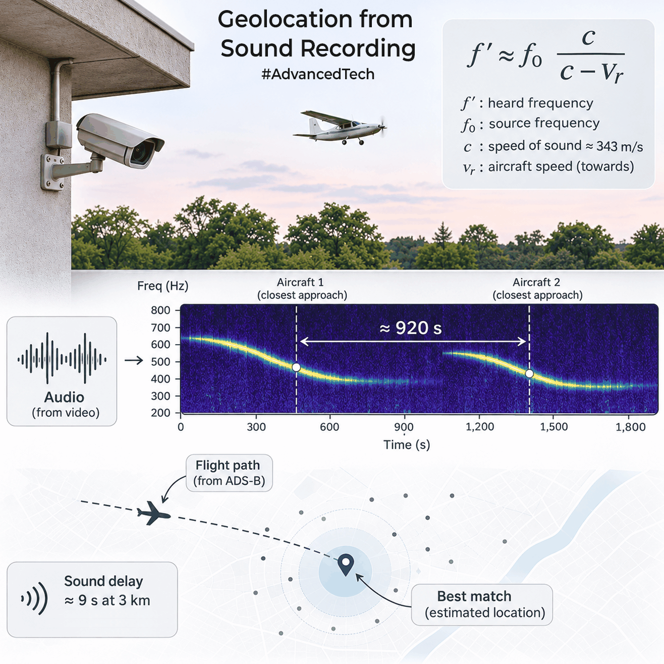
The idea is to work backwards. Known flight tracks let you predict curves at candidate microphone locations and compare them with the audio. A 3km sound path takes around 9s at 343m/s. Ground elevation, altitude, turns and changes of speed all affect the timing and shape.
Colsto found two aircraft signatures 920s apart. Searching historical US flight data, he discarded places where speed, distance or timing did not match. Silence between events removed places where other flights should have been heard. Matching both curves identified one site, verified in Street View.
Colsto hasn’t released his original code, although independent implementations have already appeared. The approach can be reproduced, but its reliability on random recordings remains unproven.
Now imagine a city like Mumbai, where the airport in the city handles roughly 950 flights daily. More flights offer more clues, but jets, traffic and reflections from buildings complicate the signal. Technically any long enough random recording will allow you to pinpoint a location. I can see how this technology could be misused, but the engineering behind it is genuinely mind-blowing. Please search online to watch the whole video if you have the time. It’s very good.
0 Comments